Pages

Monday, 23 December 2013

Snow on the Home Front, the Winter of 1940.

Winter 1940 and snow falls across the Furness Peninsula. The snow keeps falling, heavily, creating large snow drifts, blocking up doors and windows, preventing the use of roads and freezing ponds, rivers and even the sea! This was some of the worst snow the area had seen in recent memory.

"A perfectly unbelievable day! My husband could not open the garage door on the side of the house, and had to get out the dining-room window and dig four feet of snow from the back door - which opens outwards. Poor old Mr. Murphy* took a leap onto the garden and disappeared - and instead of keeping still, started to tunnel his way madly under the snow. Talk about 'lost in a fog'!- Nella Last, 1940; Nella Last's War. *Mr. Murphy was a cat.

Whilst War began across Europe the people back home in Furness were up against a different kind of battle, one against the elements!

It was the first year of World War 2, rationing had just been introduced across the country and the worst snow fall of the recent times had fallen. As can be seen in the picture above and to the right the snow grew to large heights covering over doors preventing them from being opened. The picture above shows a dug out shelter in Barrow Park and right shows Dalton Road with the snow piled up at either side of the road. The snow at this time was hardly reported in newspapers for fear of letting the Germans know that the country was at a near standstill.

"All that is talked about is that the snow has brought most of the industry in the North and Midlands to a stop. Road transport is at a virtual standstill. The railway lines and tunnels are so blocked up they have to dig them out." Says Lilian Ryan who wrote her memories of the war in a book called 'Cos That's The Way It Was: A Child's Eye View of Wartime Barrow'. She also states that "Some people in villages near us are getting short of food and their pipes are so frozen up they have to boil snow to cook with."

Coast Road bus Snowed in at Aldingham
There was a wild blizzard on January 28th which caused roads and railways to be blocked. This made communication to other towns difficult. It also made it difficult for food to get through to shops. This, with rationing on bacon, sugar and butter, made life in the area, and across the country, pretty difficult. But as always through out the War people soldiered on and made do. 


"All of Morecambe Bay stretched a frozen waste and, far across, Morecambe itself looked as if it might be able to be reached on foot. The water had not frozen flat like water but, as it dashed on to any stone, had frozen in a smother like spun of sugar." States Nella Last in her War Time Diaries. It is not often that the sea fully freezes over but in 1940 the cold was so bad that it did and stayed frozen for quite some time. With all the roads blocked for transport many people, including Nella Last, would have to walk great distances through the snow to get to where they needed to be. Nella describes in her diaries how she walked all the way to Spark Bridge from Barrow to deliver her Aunts shopping for fear "she would be short on things". It's a true testament to the kindness and generosity of humanity that people would risk their own safety and well being to help others. It is something that was very apparent during the Second World War, as well as the First.

It is difficult to imagine exactly what everyone must have gone through at this time. What must it have been like to have no water due to frozen pipes and have to boil up snow? How hard must it have been to get around when the roads and railways were blocked? We are lucky in this day and age to have not suffered though such terrible weather. Granted we have had our fair share of cold and snowy winters but nothing seems to compare with what happened in 1940, especially with a War going on at the time! Life must have been very difficult. Thankfully weather like this was not seen again during the Second World War in Furness but other struggles would have to be over come...

Sunny Bank in 1940
The Main Road from Ulverston to Barrow blocked with
snow in 1940.

Above two picture Courtesy of M Tyson/North West Evening Mail.
Vickers Works at Devonshire Dock,
Winter 1940
Holker Street Stadium, Barrow.
January 1940
Duke Street, Barrow.
January 1940 

Tuesday, 10 December 2013

Ruined Walls of a Medieval Fortification, Gleaston Castle

On the road out of Gleaston, having past the water mill, a castle expands out from a farm yard into an adjoining field. This is Gleaston Castle, a structure erected sometime around the 13th Century.

The Castle is generally believed to have been started in the mid 13th century by John De Harrington I, who was a descendant of Michael Le Fleming the first Norman to settle in the area. He constructed the south west tower and part of the west wall. It was not until 1325, 28 years later that he or his son, John De Harrington II, continued construction at the Castle. This work was completed around 1340 and the De Harrington family took residence here for 118 years. It is in 1457 that William de Harrington, the last lord of Aldingham and Muchland, died and the castle was passed on. Eventually, by marriage, the castle passed to Thomas Grey, great grandfather of Lady Jane Grey, future Queen of England. In his ownership the castle fell into a state of decay and was a ruin by 1540. At a later date when the castle was in the ownership of the Preston's one of the South towers was made habitable for the family to live in until the early 1600s. Following this the Castle had many varying owners until being bought by a local farming family, the Websters, in 1926. The family still owns the Castle today and their farm sits right next to the ruins.

The Castle is set out with four tower buildings at the corners of four curtain walls. It, in a lot of ways, is much like your typical children's play set castle, if not quite as extensive. Gleaston Castle was never fully completed which may suggest its need as a fortification became obsolete. It is suggested that the Castle was built in reaction to the Scottish wars that were taking place at the time. Many castles were erected across Furness and Cumbria during this period including Dalton, Piel, Broughton, Millom and Sizergh Castles. Gleaston was probably built to replace an earlier castle that had been overwhelmed by the Scots. It is entirely possible that the Castle was built to replace the mote and bailey castle at Aldingham (which we will look at in a future post) that would have been of wooden construction. A new stone castle would have been a lot stronger and more able to withstand a Scottish attack. Also the positioning at Gleaston may have been more defendable than at Aldighman. Obviously this is purely conjecture on our part but it is reasonable to believe. With the Scottish Wars and raids not lasting particularly long the castle may have become redundant before even being finished, thus being left incomplete. As stated above the Castle was made fit for habitation in certain areas by later owners but as a working fortification it was unfinished.

Earlier we mentioned Thomas Grey, father of Lady Jane Grey, being in ownership of Gleaston Castle. Well it is thought that Lady Jane Grey herself visited the Castle not long before becoming Queen of England! The circumstances of her visit and if she really did are unclear but it is certainly nice to think that she may have. In the present day the Castle is in a very ruinous state with most of its curtain walls missing and it's towers being empty shells. It is hard to imagine the Castle today as it would have looked when it was fresh. The southern towers are the best preserved but the north western tower is slowly crumbling away and the north eastern has completely disappeared. Even being in such a dilapidated state the Castle certainly has a romantic and aesthetically pleasing look to it. The ruined walls with the ivy growing up them makes for some lovely photographs, even if the ivy won't be helping the structure in the long run. Although  it may be holding it together for now.

Gleaston Castle is unfortunately not open to the public as it is on private land but you can see it well from the road leading past it. You can easily find the Castle by foot or by car, head to Gleaston then head north past the water mill towards Scales and you will find it as you go. The Castle is a wonderful relic of a time gone by and is quite lovely to see. If you get the chance to venture past it take a moment to stop and look, think of its past and the people who once lived and visited here!

The next instalment of Furness Hidden Heritage will be released earlier than usual on Monday 23rd December. The blog will then go on a break over Christmas and will return on Tuesday 7th January.

Engraving by Samuel and Nathaniel Buck 1727.


Tuesday, 26 November 2013

Water Reflecting an Industrial Past, Ulverston Canal

Stretching out from Ulverston town to meet with the sea at, the appropriately named, Canal Foot is Ulverston Canal. An 18th Century built canal made for the import and export of goods to and from Ulverston.

Today the canal has a number of footpaths leading to and along it for anyone to use. There is a footpath that runs along the whole canal and is a lovely walk to take. Walking along this path, if you look closely, you can see some interesting reminders of the once working canal.

The canal was once the shortest, deepest and broadest in Britain and was first started in 1793 with Thomas Sunderland cutting the first sod on June 1st. The company Pinkerton and Murray had won the contract to dig the Canal and basins. They earned 3 1/2d per cubic yard but a lack of funds ended in them being unable to complete the contract. A Mr H. Baird took over to complete the canal construction, which was now lagging behind. Originally intended to open around 1794 the Canal eventually opened over two years late in 1796. Locals gathered around the locks at Canal Foot to witness The Sally be the first vessel to enter the Canal. A further three vessels entered after including The Content which was pulled with rope along the Canal by the crowds. The Content managed to overtake The Sally and was the first to reach the top basin of the Canal at Ulverston!

The Canal was built for the import of coal, cotton, timber, spirits and sugar to Ulverston and the surrounding area. It was also used to export charcoal, slate and linen to the rest of the country. With the newly built Canal many industries sprang up along it's edge including an iron founder, a timber yard and appropriately a sail maker and a boat builder. The Canal opened up new possibilities for industry and trade providing a new platform to export across the country and even beyond.

Along the Canals edge you can come across interesting remnants of the past. The footpath on which you walk is the 'towpath' of the Canal, which, as its name suggests, would have been used to tow sail-less boats along the canal. Humans or horses could have used this path to tow the boats. Along the towpath there are small metal capstans, pictured to the left, which boats could be tethered to, to prevent them drifting off in the water. There will no doubt be many of these hidden amongst the undergrowth along the canal so keep an eye out for them. Running next to the towpath is the back drain, this would have been constructed to drain any excess water from the canal to keep it at a set level. It would have been important to keep the water level at a set point to avoid flooding at the many industrial sites springing up right next to the canal.

Trade hit its peak on the canal in 1846 with 944 vessels entering it that year. With the discovery of iron ore in Furness the need of a railway to transport the ore to Barrow became evident. It was in May 1844 that a Furness Railway Bill was passed and a railway opened in 1846. By 1854 the railway had reached Ulverston and with this came the decline of the Canal. In 1857 a new section of line opened that cut right across the Canal. As pictured to the right a viaduct, to take the new track, was built across the Canal, this prevented tall ships from reaching the top basin. Iron became cheaper to transport by rail than by boat, this along with the viaduct's construction saw the end of the Canals dominance in industrial transport. Eventually, in 1949, the Canal was empty of boats and the lock gates at Canal Foot were sealed with concrete never to be opened again. The lock gates still remain today, if in a state of disrepair, as a lasting reminder of the Canals glory days in the 18th and 19th century.

The Nahula sitting as the last boat on Ulverston Canal.
She was the last vessel to ever sail through the lock gates.
The Canal is easy to access and is great for a nice leisurely walk on easy terrain. There is plenty of space to park at Canal Foot and the footpath running alongside the Canal takes you for just over a mile to the top basin. If you go for an explore keep an eye out for the various hidden heritage including the lock gates, the capstans, back drain and of course remember that you are walking in the footsteps of our ancestors on the towpath! Also look out for some old rail tracks cutting across the path that would once have linked up to the Iron Works that was established across the Canal. There is even a red brick tower standing on the other side of the Canal that may have been part of the Iron Works.


The Act for the construction of the Canal
published on 8th May 1793.

Tuesday, 12 November 2013

Fading Faces in Medieval Quarries - The Amphitheatre Next to Furness Abbey

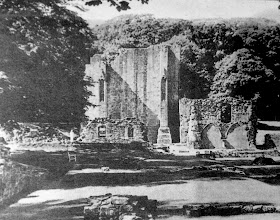
Many people will know of Furness Abbey, the stunning red ruins that expand from the earth in majestic beauty, but you may not know some of the heritage that is hidden in the land surrounding it. In this post we will explore some of the interesting areas that lie just off the beaten path around the great natural Amphitheatre from medieval quarries to the Custodian's Cottage, the last remaining building from the time of the Abbey to still be in use today!

Spreading out from the Abbey ruins is the appropriately named Amphitheatre. This area of land is so named as nature has created a large curving bowl, with large steep sides sweeping around the land below forming part of the valley of Beckansgill. In and around the Amphitheatre there are many interesting features that hint at the Medieval construction of the Abbey itself. To the far left of the Amphitheatre, as you look from the nearby car park, there is an area of trees sitting on the slope. If you were to strip away these trees you would find the remains of a quarry once used by Monks to cut stone for the Abbey walls. You can visibly see two track ways that extend out from this quarry. One sits about half way up the slope and curves around the Amphitheatre while lowering to ground level where it ends at the foot of the slope. Another is just at the top of the slope and curves right around the area to another patch of trees on the right, we will talk about what lies in these trees later. As well as the two tracks there is a distinct ditch that runs down the slope from the top track to the bottom one. It is uncertain what this is but could it be where stone, dragged from the quarry along the top path, was lowered to the bottom path to then be taken down to the Abbey?

One of the most notable features that can be seen stretching across the top of the Amphitheatre is the impressive Abbey precinct wall. This wall, built of the same red sandstone as the Abbey, marks the limit of the main religious precinct. To gain entry beyond these walls in to the precinct required vigorous checks and not any old person was allowed in! Over by the Abbey car park there are the ruins of a three gate, gatehouse, which any visitor would have to pass through one gate at a time. In Medieval times the floor of the Amphitheatre would have been littered with various Abbey ancillary buildings including a brewery and bake house. Unfortunately any evidence of these buildings on the surface has been destroyed when the area was flattened for a rugby pitch many years ago. Who knows what buildings could be hidden beneath the surface!

As mentioned earlier there is another area of trees on the right of the Amphitheatre, just next to the Abbey. Within these trees can be found the chisel marked stone faces of another Medieval quarry! As the other quarry the monks would have cut the sandstone from these rocky out crops and take them to the Abbey for use in the walls. The amazing thing with this quarry is that you can still see the chisel marks from the Medieval quarrying clear as the day they were first cut. It really is quite brilliant and gives a real connection to the past! Also with in this quarry you can see two heads carved into the soft stone. These carvings are believed to date back to Medieval times also. One is in better condition than the other but they can both be seen clearly amongst the chisel marks. Leading away from the quarry are the remnants of a track way used to drag the stone from the quarry down to the Abbey construction site. The track splits through the landscape heading down to the current road and is easy to see amongst the trees. These little hints of the early days of the Abbey are wonderful and personally they are some of my favourite things to look at as there is such a strong connection to the people who worked so hard to build the Abbey!

The Abbey Mill Cafe, previously the Custodian's Cottage, is a well used and well loved place but in the days of the Abbey the building would have looked a lot different. This building was constructed in the Middle Ages and was one of the ancillary buildings of the Abbey. On both sides of the building at ground level you can see window frames and door frames half covered by the earth. The whole cottage has sunk 4 feet into the ground since the structure was built, much like the Abbey has. This is due to the fact that the Cottage and Abbey were built on once marshy land so the weight of the structure on the damp ground pushed the stones down leaving the building as it is today. Inside the building you can also see where the original second floor would have been, now a couple of feet above the floor.

It is often thought that the Cottage was a mill but this isn't actually true as there is no evidence to point to this. It is currently believed that it would have been the Lay Stewards Hall, a much more significant building. The Lay Steward would have looked after the financial aspects of the Abbey. Evidence points to the cottage having once been a much bigger building. Remains of door frames at the second floor level suggest that the building would have extended out further to the rear and to the front. It is theorised that it would have been three times the size it is today creating a longer rectangular building. Hidden under the earth around the Cottage is a blocked watercourse, which could once have put the building on an island! Man hole covers in the grounds give an idea of the direction of this watercourse.

To the rear of the building amongst the long grass is a large, low, arch. This arch is thought to have been erected in Victorian times. No one is sure what exactly it was for but it may have just been a garden feature, made to look 'pretty'.

Across the railway tracks from the Custodian's Cottage is a large field split down the middle by the ruined precinct wall. Outside of the precinct wall is Bow Bridge, a 15th century construction used to cross the stream, but inside the wall is the site where the Abbey fishponds would have been. Look closely in the base of this field and you can just about see some faint earth works, these are thought to be the remains of the fishponds. After heavy rain this area can often fill up with water amongst the earth works. Fish was a large part of the monks diet as meat was generally forbidden (accept for certain occasions) so breeding fish on site was a very useful thing to do.

There is such a huge amount of hidden heritage in the area surrounding Furness Abbey that it is difficult to compile it all into one blog post, this post has looked specifically at the Amphitheatre but there is so much more to see in other areas. Hopefully in a later post we shall look at the other areas so keep an eye out for that.

The next blog will be online on 26th November and will take a look at Ulverston Canal, until then why not go in search of the sites we have written about here? Let us know if you find anything we may have missed!

Images from around the Amphitheatre:


Medieval trackway from one of the Quarries
Believed site of the Abbey Fishponds
The Abbey Valley. The base of the Amphitheatre, one quarry in the trees on the right.
The Fish Ponds Field behind the Railway 

Thursday, 31 October 2013

Furness Ghost Stories - Halloween Special!

In this special blog post we will take a brief look at some of the ghost stories from around the Furness Peninsula. Be sure to read with the lights off!

Furness Abbey - Apparitions and Hooded Figures


Furness Abbey has been linked to many spooky tales since its dissolution in the 16th Century but we will only look at two here.

It was new years eve 1980 when a young man was peddling away on his bike to get home after finishing work at the Abbey Tavern. As he was in a rush to get to a party he decided to go home by cycling past the ruins, usually he would avoid the ruins by heading straight out onto Abbey Road. He quickly got by the ruins only glancing at them once. As he came to the junction he headed off up towards Rating Lane along a dark and poorly lit road. When he reached the ruins of the West Gate, that towers above either side of the road, a strange feeling came over him. He looked up to see the shadow of, what he believed to be, a cowled monk on horse back. The figure held his gaze for a moment until car headlights on Rating Lane broke his stare and he peddled off hard and fast! There have been several sightings of a monk wandering towards this broken archway over the years, who could this mystery monk be?

On many occasions apparitions of monks have been spotted amongst the haunting ruins of Furness Abbey leaving witnesses baffled and frightened.

Image taken from North West Evening Mail newspaper.
Original Image by Roy Chatfield
A photographer has even caught on camera what he believes to be a ghost in the Abbey grounds. The man had taken many images of the Abbey one day but when he developed the images he was shocked to discover one of them had a white hooded figure standing in it, near to the church tower. The photographer swears that no one was there on the day and he didn't see anything through the viewfinder on his camera when he took the picture. The image was also taken on a 8 second exposure which would blur someone who happened to be walking by! You can see the image to the right, what do you think? Is it a monk or is it something else all together?

The Custodian's Cottage/Abbey Mill Cafe - A Ghostly Face and Buried Body


The former Custodian's Cottage next to Furness Abbey, now the Abbey Mill Cafe, also holds some ghostly stories of its own. Many years ago when the cottage erupted in flames local firemen descended on the site to tackle the blaze. While they fought to tame the fire many of the firemen claim to have seen a young girl at the top window of the building. Due to this they were certain that they would find a body in the fire damaged carcass of the building but when they searched the rubble no body was found. Was the face they saw in fact the spirit of a long dead girl who once lived at the Cottage? Who can say! But what is interesting is that once, when a psychic visited the Cottage she could sense something beneath the floor. Today the large main room of the Cottage has a wooden floor but 7+ years ago you had to step down a few steps to reach a concrete floor. When this psychic came she stood on the concrete floor and could sense that, in the far right hand corner of the room, there was a body buried 4 feet under the ground. If you were to measure from the actual ground level outside this would be 6 feet. The interesting thing about this though is that she claimed it was the body of a child! It does make you wonder if this could possibly be the body of the young girl who was seen at the window when the Cottage burnt down!

Dalton-in-Furness - Haunted Pubs and Highways


It is thought that a building has stood in the place now occupied by the Brown Cow Inn in Dalton since the Middle Ages and this has led to several ghostly tales being told. One such story, which has not been noted since the 19th Century, is of haunting chanting being heard coming from the direction of the Abbey. This chanting was often accompanied by the sound of a church bell ringing which led witnesses to believe it was the Monks of the Abbey singing. Another story from the Brown Cow involves witnesses seeing a strange apparition. Back before the interior of the pub was open plan as it is today a man took his drink into one of the small rooms to sit at one of the wooden tables. On entering the room he was rather surprised to find an oddly dressed stranger sitting in a seat near the window, staring out through the glass as if he was looking and waiting for someone or something outside. The figure sat quite still not making a sound. The man who had entered the room greeted the stranger but was met with no reply. Later when the man left, returning to the bar he asked the landlord about the strange fellow in the other room. The landlord informed the man that no one, other than him, had entered the room that night. When the curious landlord accompanied the man back to the room they found no one inside, much to the mans surprise! There was no way that the stranger could have left the room without being seen or heard!

A young man of the name Tom, who lived in Dalton, once worked in the mines at Roanhead. One morning when he was cycling to work by Millwood he saw another man cycling towards him on the other side of the road. The other person was middle aged wearing a grey suit and a brown trilby hat, nothing too unusual for the time. Tom continued to cycle along not thinking much of it. Suddenly, when the two were only a few yards from one another, the other person suddenly steered his bicycle directly at Tom! Tom broke hard and almost fell off his bike swerving away from the other man. When he turned around to give the man what for he was shocked to find the road empty of life. There was nowhere the other man could have gone to hide; he had completely vanished!

Other Stories

Shadowy figures and loud bangs have all been associated by employees at BAE Systems, in Barrow, to the spirit of a worker who had killed himself.

A couple who were traveling through Leece one evening had to slam on the brakes and come to a stop. A large black creature was sat in the middle of the road stopping them from getting past. The creature stood about 2 meters tall and had bright yellow eyes! Eventually the beast stood and walked off the road allowing the couple to drive by. It stood on the grass verge watching as they went.

In 2009 the North West Evening Mail ran a small article about Abbots Wood house, which included a picture from inside the house. On publication though many readers wrote in as they had noticed something in the far right of the interior image. There was the ghostly shape of a woman stood behind a table! Could it be the ghost of a previous occupant? Who can say but with the house no longer standing her home is long gone. Here is the picture for you to view; can you see the ghostly figure?

Image courtesy of the North West Evening Mail
Originally printed in 2009
We hope you have enjoyed this special spooky edition of Furness Hidden Heritage, if you know of any other ghost stories from the Furness area please let us know and we may use them next Halloween! Business as usual with the blog will resume on 12th November so be sure to check back then for a post on the area surrounding Furness Abbey. Until then happy Halloween and sleep well!

Read more Furness ghost stories in our second Halloween special here - https://furnesshiddenheritage.blogspot.com/2013/10/furness-ghost-stories-halloween-special.html

Tuesday, 29 October 2013

An Anti-Aircraft Gun, A Dog Carving and A Doctor - Market Place, Dalton

Dalton, nestled amongst a valley to the south of the Furness peninsula, may be a small town today but once it was the capital of Furness! The town is rich with a long and vivid history much of which can still be seen today, but scratch the surface and there is a wealth of hidden and forgotten heritage waiting to be found. In this post we will take a look at one part of Dalton, Market Place; the ancient heart of the town!

Sitting on a plateau on the edge of the valley is Market Place, the area where Dalton originates. It is here, around the Church, where the town built up from a, possible, prehistoric settlement to the ancient capital of the area.
The earliest evidence of settlement at Dalton was thought to be found where the Church and graveyard is today. Earth works that used to be visible in the Churchyard before 1850 were excavated at the beginning of the 19th Century.

In the past the earth works were believed to be the remains of a Roman fort built in AD 79 by Agricola as he advanced through Britain. A priest and historian, Father Thomas West, was convinced of this and wrote about it in his book 'Antiquities of Furness' published in 1775. But it was later when a local historian and surgeon, William Close (a man we will talk about later), undertook excavations on the earth works that this theory was proven to be wrong. The excavation provided no positive proof of Roman occupation with no artifacts from the time being found. Today, although all evidence of the earth works have been destroyed, it is believed that the features were evidence of an Iron Age settlement. The site certainly is the perfect place for such a settlement being on a plateau with good views all around and a stream not far away for water.

One of the most prominent features that stands proud on Market Place is, of course, Dalton Castle! The Castle is a small fortified piel tower which was erected by the monks of Furness Abbey as a court house and defensive structure. The Castle dates back to the 14th Century and has gone through many changes in its time. We wont get too much into the Castle and its history in this post, as we might be here awhile, but we will do a dedicated post about it in the future!


In front of the Castle is where the town market, which Market Place takes its name, would have been held. It was in 1239 that a Royal Charter was granted to Dalton giving permission for a weekly market. Although a market has taken place here since then the only evidence that can be seen today is of the Victorian market. Stretching in a half moon shape around the square are the marble slabs, known as fish slabs, once used for the market. These table structures were built in 1869 and are made from marble as the stone stays cool, even in the sun, which makes them perfect for displaying meat, fish and cheeses without them getting warm and going off. Interestingly enough if you look closely at the fish slabs you can find a carving of a dog! It is unclear when this carving was done but it certainly isn't a recent piece of graffiti. We would suggest it dates to somewhere around the 19th - early 20th Century. If anyone reading this has further insight into this please let us know!


At the centre of the market square stands the market cross, a feature that has undoubtedly been present in some shape or form since Medieval times. The first cross erected on the site would have no doubt been made from wood but it is hard to say when that was and when it was changed to stone. What can be established though is that in the 1700s and into the 1800s the cross was not the familiar cross we see today but was in fact a St. Andrew's cross. But notice in this image (see right) from the mid to late 1800s that the market cross doesn't appear to have any cross at all. You can see the pillar that would support the cross next to the bottom right window of the large building, but there is no cross. The building seen here in front of the Castle is the offices of solicitor Mr. William Butler, built in 1850/1 and later used as the Town Hall. It was in 1869 that the market cross was changed to be the one we see today.


Earlier we spoke of a Dr. William Close, a man who lived in Dalton for 16 years before his death in 1813 at the age of 38. Close spent his early years on Walney where he lived with his family. Later in life he studied at the University of Edinburgh Medical School and on obtaining his diploma in 1797 he immediately began medical and surgical practice at Dalton. As well as being a Doctor and surgeon Close was a keen historian, archaeologist, musician and artist. He also enjoyed physics and general literature. Close is noted as inventing an 'Engine for raising water by the lateral Communication of Motion' which was used in mines. In 1799, within years of Jenner's discovery of vaccination to prevent smallpox, Close introduced inoculation to the Furness Peninsula. He took up a residence at Rampside and made it so all the children of the lower classes could be inoculated at his expense. Doing this he not only confirmed the efficacy of the newly discovered vaccination but he also freed the area of smallpox within five years! A remarkable man who undertook so much in his short life that he is worth recognition. You can find the house in which he lived on Market Place behind the castle Chinese, marked with a blue plaque.

An interesting fact that many may not know about Market Place is that once, between the Castle and the now Chinese takeaway, there was a field gun and an anti aircraft gun! These guns were captured from the Germans in World War 1 and were brought here as mementos. These guns are no longer here and where exactly they went is hard to say but one can assume they were taken for scrap metal during World War 2.

Market Place in Dalton has a fascinating and rich history dating back thousands of years. There is so much to discover here that we have only just scratched the surface in this blog but we hope we have enlightened you to something you didn't know before. Why not take the time to go for a wander around Market Place and enjoy the visible heritage that still remains?


Interesting Old Images and Drawings of Market Place:


Images of Market Place Today: