Pages

Showing posts with label Furness Hidden Heritage. Show all posts

Tuesday, 12 March 2019

Lost Railway at Greenodd | Snapshot Series

The small village of Greenodd, just off the A590 on the way in or out of Furness, today is a quite place with a few local amenities among the houses. Back in the 1800s though the sound of steam trains would have been heard regularly puffing by the village.


It might be hard to tell now but Greenodd once had a busy railway line running alongside it, as well as it's own station.

The line was opened in 1869 as part of the new Furness Railway, which was connecting much of Furness with Lakeside for the easy transport of goods.

The train line would have had many trains with industrial cargo hammering though but there was also a passenger train, which people could board from the station. This station once stood near the end of current Main Street with the railway running where part of the A590 now sits.

There isn't much evidence of the long lost train line but it’s nice to know that one once ran here.

Greenodd Station, image courtesy of NW Evening Mail.


The Snapshot Series is a series of short posts on singular locations, features or artefacts found in the Furness area. Not large enough to warrant a long blog post we will explore these sites in snapshots!


Sunday, 10 February 2019

New Interactive Furness Heritage Map

I’ve been doing a bit of work on the Furness Hidden Heritage web page and have just released a new interactive map of Furness heritage.

In this new map you can navigate around the Furness area and click on the pin points to reveal more info about a site and find links to related blogs.

This will develop as new material is added so do keep checking back!

You can view the map on the website here - furnesshiddenheritage.co.uk/map/ or have a look below...


Tuesday, 5 February 2019

Sir John Barrow's Cottage, Ulverston | Snapshot Series

Sitting on the junction of two Ulverston roads stands a small building once home to Sir John Barrow.


Sir John Barrow, as mentioned in an early post about Hoad Monument, was born in Ulverston during the 18th Century and went on to be a founding member of the Royal Geographical Society.

This small cottage at Dragley Beck was where he was born on 19th June 1764.

It would have looked a little different back then, for a start the roof would have likely been made from thatch and there would have been a garden wall sweeping round the front of the building.

At the time Dragley Beck was also a small village in the parish of Ulverston. It certainly wouldn't have been as busy as it is today. Of course as time moved on the village was fully enveloped by the growing town.

John grew up in the area and went to school at Town Bank Grammar School in Ulverston. John left at the age of 13 though to set up a Sunday School for the poor, before moving to Liverpool where he found work at an iron foundry.

This building is a wonderful remnant of the past and it is excellent that it is still standing today.


The building is now looked after by Greenlane Archaeology who open it at various times throughout the year. You can find out more on their website here.


The Snapshot Series is a series of short posts on singular locations, features or artefacts found in the Furness area. Not large enough to warrant a long blog post we will explore these sites in snapshots!


Tuesday, 4 December 2018

Heritage From the Air | Series 1 Montage | VIDEO

Over the last year we have been exploring some of the wonderful historic sites of Furness from above in the first of our Heritage from the Air series.


Series one of ‘Heritage From the Air’ has seen us take to the skies above Birkrigg Stone Circle, Heathwaite Medieval Farmstead, Gleaston Castle, Aldingham Motte and Aldingham Moated Manor. Each episode giving a greater sense of this wonderful heritage and their surroundings.

To round off series one we now have a special montage using footage from the first 5 videos. Hit the play button below to watch and enjoy Furness Heritage from the Air:


Tuesday, 21 August 2018

Hoad Monument, Ulverston | Snapshot Series

One of the most prominent features visible from the Furness town of Ulverston is the random lighthouse that sits upon a hill above the town - the Hoad Monument.


Even though it appears as such the monument is not a lighthouse, well not a working one at any rate. It is in fact a monument to Sir John Barrow, a man born in Ulverston during the 18th Century, who went on to be a founding member of the Royal Geographical Society.

The monument, real name the Sir John Barrow Monument, was designed in the style of a lighthouse and built on the top of hoad hill on the outskirts of Ulverston. It was built using local limestone in 1850 and stands 100ft tall.

It cost £1250 to build and was paid for mainly by public subscription. It soon became an iconic image of the town and held a special place in the hearts of locals.

This still stands today with the view of the 'Pepper Pot', as it is also refereed to, when driving home is an instant reminder that you are almost there. Many people walk up the hill to wander around the monument every day and enjoy the views up the tower or out across Ulverston.

It really is adored by everyone and will continue to be a lasting symbol of Ulverston and, indeed, the Furness peninsula.


The Snapshot Series is a series of short posts on singular locations, features or artefacts found in the Furness area. Not large enough to warrant a long blog post we will explore these sites in snapshots!


Tuesday, 7 August 2018

Aldingham Motte from the Air | VIDEO

Aldingham Motte is all that remains of a Norman Motte and Bailey castle, once home to Michael Le Fleming.


Much of the original castles bailey has been lost to coastal erosion, as has part of the motte, a large mound where a wooden strong hold once stood.

In this video we take to the air to view what remains from above to give a sense of it's scale and how much erosion has taken of this once impressive Norman structure:


Video footage Copyright © Furness Hidden Heritage 2018, all rights reserved.

As well as the wonderful motte on show here, with it's surrounding ditch, you can also spot the marks of medieval farming with many ridge and furrow features visible in the fields surrounding the motte. Something I personally love to see. This land was no-doubt farmed following the Le Flemings moving down the hill to a new moated manor.

You can find out more about Aldingham Motte in our previous blog post 'A Motte Without a Bailey and a Manor Without a Town, Aldingham', just click here.


Tuesday, 17 July 2018

A spire seen across the town - St. James' Church, Barrow

Across the town of Barrow-in-Furness, if you look across the skyline, there is one heritage building that can almost always be seen - the spire of St. James' Church.


This lovely looking church was built, along with many other historic building in Barrow, during the Victorian period and sits in the Hindpool area of the town.

The site for the church was gifted from the Duke of Devonshire - one of the major players in the town at the time. Soon after this the Directors of the Iron and Steelworks, big businesses in the town, provided the money to build the church.

Once money was obtained the architects Edward Paley and Herbert Austin were hired to design the building. The two went on to become famous for their many church designs across Northern England.

The building was constructed using local bricks, in the familiar red hue that one associated with the town, and has contrasting yellow sandstone forming the windows and decorative features. The final construction is large and grandiose but has a beauty of it's own. It's 150ft tower rising up to touch the sky and create a landmark seen across the town.

This is something that was used to the advantage of the Germans during the Second World War.

Incoming bomber planes, destined to hit the shipyard, are said to have used the tower of St. James' as a marker. They would fly towards the tower, turning on reaching it to gain a direct line to the shipyard.


During the German air raids of 1941 the church sadly received damage. Several stained glass windows were destroyed, the organ was damaged and a floor in the spire collapsed onto the bells inside. Unfortunately many of the surrounding buildings were completely destroyed in the air raids but the church managed to stay mostly intact and remained as a symbol of hope for the local townsfolk.

One interesting fact I'd like to leave you with is about the organ just mentioned. This organ is rather special, it started life in 1837 when King William the Fourth commissioned it's construction. The organ was built inside the Chapel Royal of St. James Palace - the royal palace at the time.

Here the organ was played at many royal occasions including at the marriage of Queen Victoria to Prince Albert of Saxe-Coburg.

Several years later, in 1868, the organ was to be replaced so was sent to Barrow to be installed in St. James Church, where it still stands today.

St. James' Church is a wonderful building on the skyline of Barrow, it stands as a lasting reminder of the towns incredible Victorian past and is well worth a look around if you're ever in the area.


The Churches of Furness Series does what it says on the tin, it takes a look at the many and varied churches of the Furness area of South Cumbria. From churches with Norman origins to Victorian houses of worship there certainly is an array of religious buildings to discover! 


Monday, 25 June 2018

Gleaston Castle from the Air | VIDEO

The romantic ruins of Gleaston Castle are well known in Furness but take to the air and the site takes on a new dimension...


Back in 2013 we took a look at the fascinating, if sometimes unclear, history of Gleaston Castle. Now, some 5 years on, it was time to revisit the site from a different perspective - from the air.

In this short video you can see a variety of aerial shots taking in the splendour of this medieval ruin and the area it sits in:


Video footage Copyright © Furness Hidden Heritage 2018, all rights reserved.

The ruin is sadly in bad repair, as is made evident from the large cracks that can be seen rising up through several of the walls, but it still forms quite the impressive structure. Three of it's four towers are still standing proud, with door ways and windows often still intact.

It can be hard to get a real sense of what this castle once looked like or how it once was used but this video at least gives a new perspective on the ruin and shows just some of its former majesty.


Tuesday, 5 September 2017

A ram's head and a chimney - Ramsden Hall, Barrow


What do you think of when you see an image like the one to the right? 


Industry maybe? Mills and factories of the Victorian age perhaps?


Well, if so, you would only be partly right!

This lovely chimney is from the Victorian period, built in the typical red brick of the Furness area, but it is not attached to an industrial mill, nor is it from a large factory. or yard

It is in fact attached to a rather fine building which once housed something of a much more gentile nature, a community bath house, gifted to the town by the first mayor of Barrow, Sir James Ramsden.


Ramsden commissioned and funded the building of this, quite small, public bath house in 1872 and it was constructed in that same year.


On completion the building was given the name 'Ramsden Hall', a reminder of who funded it. Another reminder of this is situated above the main entrance to the hall. Carved into yellow sandstone is an inscription that reads 'Presented to the town by James Ramsden Esq. First Mayor'.

Just below this is another interesting feature of the building, and something I personally have always associated with the building since childhood, a ram's head. This ornate carving forms the centre part of the archway above the main entrance door and is rather wonderful. The ram of course being a symbol for Ramsden.


The chimney, mentioned at the opening of this post, sits to the rear of the building and would have sat directly above a boiler room of some variety. This boiler would have heated water which would be used for bathing, a steam engine most likely being used to do this pumping. The chimney would be used to vent out smoke from coal or wood which would be burnt to heat the water and operate the steam engine - something which would be a common site across the town at the time.

The building sadly did not remain as a bath house for long as in 1886 it was converted into a public hall. It also went on to become an annex of the technical college, which stands next to the hall, before becoming the Citizens Advice Bureau, which it remains to this day.

Ramsden Hall is a wonderfully cute building on the streets of Barrow. Sitting on Abbey road between the former Houses of Parliament Pub and the now Nan-Tate Centre this building is one of a kind. It is the last remaining public bathhouse from the 19th Century left in the town and is a beautiful piece of Victorian architecture, one I hope remains out of harms way for many, many more years to come!

Tuesday, 23 May 2017

The Remnants of a Lakeland Industry, the Haverthwaite Charcoal Burner's Huts

To the top of Furness and inside the Lake District National Park, just before reaching Windermere, is the quaint village of Haverthwaite, a village best known for its steam railway.


To the south of the village is a large area of woodland known as Haverthwaite Heights. Although now a peaceful, isolated and beautiful area of wildlife this woodland would once have been alive with industry, the industry of charcoal burning.


Charcoal was a product in demand during the Victorian era with many large industries, like steelworks, requiring large amounts of charcoal to burn and produce high heats. Due to this many of the woodlands in the area and across the Lake District would be littered with charcoal burners and the huts they stayed in.

Photo of a charcoal burner's hut  (with charcoal burners)
at Backbarrow a mile or so away.
Charcoal burning takes along time and requires overnight attention so the men who undertook the process would build shelters out of stone and wood often using thatch or turf as a roof. These shelters could then be used as a base while working and somewhere for the men to lay their head down when they had a moment.

The remains of several of such structures can be found dotted across the woodlands on Haverthwaite Heights. These examples were created with a low stone wall as a base which would most likely have then had wooden posts stretching up around the wall to meet in a point creating a tepee structure.This would then be covered with thatch or turf - turf being a better option as it isn't flammable.

Interestingly many of these structures have sizable holes through their walls opposite their entrance. These may well have been for a metal extraction pipe/chimney for a log burner, something to bring a bit of comfort to the otherwise rustic accommodation.

All that now remains of these once well used structures are the low level ruined walls which created the foundation of the wooden structure above. They are a wonder to stumble across and certainly evoke an image in ones mind of days long gone when the men, in their waist coats and flat caps, faces blackened from the charcoal and soot, would emerge from their huts to check their wood burn. Producing masses of charcoal ready to be sold to the steel works or the iron furnaces, working long hours to make ends meet and provide for their families. It certainly can't have been an easy life but I am sure it had many joys.

Several footpaths run through Haverthwaite Heights but I found the best walk was to park up in near by Backbarrow, walk under the railway, through a small tunnel, and head up onto the top of the heights to descend down onto Lanes End, the charcoal burner's huts being found as you make your descent. There is a relatively steep ascent but it is certainly well worth the effort of climbing, not only to find the huts on the way down but for the stunning views from the heights.


Tuesday, 9 May 2017

Little Mill, Dalton | Snapshot Series

Tucked away in a small wooded area on a footpath between Dalton and Barrow-in-Furness is a hidden remnant of the past, the remains of Little Mill.

Originally built by the monks of Furness Abbey Little Mill would produce flour for the monastery from grain, using a waterwheel to power the mill stones. It was one of many mills the abbey owned and ran across Furness.

A man made mill pond would have been situated above the mill, filled with water diverted out of the near by Poaka Beck. A water shoot would bring water from this pond to the mill and send it cascading over the top of a large wooden waterwheel. This powerful stream of water would turn the wheel which in turn moved all the cogs and mill stones within the mill building, grinding corn into flour. Where exactly the mill pond was situated and where the shoot was placed is unclear but you can still see evidence of where the mill once stood. Several ruinous sandstone walls give an idea of where the mill buildings once were and there is even a mill stone partially buried in the ground near to these walls.


The mill was in use right through to the 19th Century but the building of the nearby railway brought an end to production at the mill. It was lived in for a time but eventually was left to rot and be mostly demolished.

You can find the site of Little Mill along the footpath leading from Goose Green in Dalton to Furness Abbey (part of the old Cistercian Way). You will stumble across the above mill stone, likely a remnant from the mills later activity, sticking out into the path, look towards the trees behind this to discover the mill site.

It is well worth a wander down this lovely old footpath to truly walk in the footsteps of our ancestors and find this hidden part of our local history.


The Snapshot Series is a series of short posts on singular locations, features or artefacts found in the Furness area. Not large enough to warrant a long blog post we will explore these sites in snapshots!


Wednesday, 26 April 2017

A Medieval Farmstead upon a Furness Fell | VIDEO

Heathwaite Fell, sitting to the north of the Furness peninsula, is a vast and wild place but hidden amongst the bracken and the windswept fields is a hidden gem. A medieval farmstead!


This farmstead is the highlight of a dispersed medieval settlement with it's associated field systems spread across the fell.

The farmstead, which is of more than one period of construction, consists of five interlinked enclosures made from stone walls with a domestic area to the north. A couple of these enclosures have land which has been improved for agricultural cultivation with the rest being un-improved and most likely for animal grazing. There are also a few small rectangular structures within the enclosures. Their function is unclear but I do wonder if they may have been sheep pens for isolating and sheering sheep.

To give you a better understanding of the layout of this farmstead and give you a better view of it we took to the air to film this breathtaking video:


Extending out from the farmstead is a selection of field system made up of banks and walled areas. The largest of these fields being around 5.7 hectare in size with all containing the archeological feature known as ridge and furrow, a feature spoken about in a previous post. These features give evidence to the cultivation of this land for the growing of crops. 

Close to the farmstead there are also three kilns. The one pictured below being on its east side. These kilns are made from thick, circular stone walls with large outer banks and deep central hollows. Two of these kilns, interestingly, have been constructed from former Bronze Age clearance cairns. These cairns were created when Bronze Age man cleared land for cultivation. To do this they removed large amounts of stone and rock from the fells and deposited them in large piles known as cairns. In the medieval period some of these were re-purposed as kilns for creating potash.

Potash was made from bracken or wood and was used to make soaps for the woollen trade - an industry that made vast amounts of money for the local abbey. Potash was created by burning wood or indeed bracken, which makes sense here as bracken covers much of the fell, removing the ash to then dissolve it in boiling water. Following this the solution is evaporated in large pots to leave a white residue, the potash (potassium chloride). 

It is also theorised that these kilns may have been used to dry timber for use in smelting lead ore, it feels more likely though that they were used for potash as sheep were almost certainly reared here and no doubt had their wool shorn here.

This fascinating remnant of our medieval past truly is a hidden gem. It's remote location gives stunning views of both the Lake District fells and the Duddon Estuary, it's low lying remains give a tangible connection to the past and the lumps of and bumps of the ridge and furrow give you a sense of the true grit and determination our ancestors had when cultivating the wild land they lived in.

A road runs near to this wonderful site and a short walk will get you right to it. It is well worth a visit and will open your eyes to our medieval past here in Furness and those men and women tirelessly working the land.


Wednesday, 5 April 2017

Built by Monks, Dalton Castle

Standing proud overlooking Dalton, the ancient capital of Furness, is the small but impressive pele tower known as Dalton Castle.


The monks of Furness Abbey built the castle in the 14th Century as a manorial courthouse for Furness. This is where the abbot exercised his right to hold courts and administer justice, as authorised in the abbey's foundation charter from 1127. The building held the courtroom, rooms for the lordships business, guardrooms, stores and several dungeon rooms.

The building also acted as a defensive structure against the possibility of Scottish attack. The tower has several statues sat upon its roof, statues of archers and armed men. These were to give the impression that the site was protected and had several men at arms. This would then deter any attackers, or at least that was the theory.

The inside of the castle has changed much over the centuries since its completion in the 1300s but it still retains several of its original features. For example the spiral staircase leading up from the garderobe and several dungeons dug in beneath the floor. Unfortunately other original rooms have been lost to time, especially after a radical alteration in 1856 when the upper floors were removed for a single room and new staircase.

The outside has changed a fair amount also. Several building were built onto the front of the castle over time from shops to a solicitors office, later used as the town hall. All these building have long since gone only leaving faint reminders of their presence with sandstone lines across the walls where the buildings may once have attached.

After the dissolution of the monasteries in the 1500s the castle remained as a court for over 300 years, owned by a variety of different people including the crown and three dukes. Eventually the Duke of Buccleuch gave the castle to the National Trust who still own it today. The building is run by the Friends of Dalton Castle with the direction of the National Trust and is open on Saturday afternoons throughout the summer months. Take a look on the NT website for more info.


This quaint little pele tower is a wonderful piece of history standing on the streets of Dalton. It can be seen from many parts of the town, often dominating the skyline and is well worth a visit. It may be small but it holds a huge amount of history and although not open often it will certainly be worth making the effort to see inside.

Once you have you can always pop down the road to see St. Mary's Church or even further to see the Pinfold which we took a look at in a previous post.


Tuesday, 14 March 2017

The Roxy Cinema, Dalton | Snapshot Series


This photo was taken in 1997 and shows the then dilapidated remains of the old Roxy Cinema and bingo hall in Dalton. The building was one of the 'Picture Palace' style cinemas, the name visible at the top of the building in the photo above. These 'Picture Palaces' became popular in the 1930s and were built in many towns across the north west.

A cinema had stood on this site since 1912 when two men, Backhouse and Drinkwater, built the Empire on the site of a former brewery. This was Dalton's first cinema and became a popular place to be.

In 1936 however the interior of the building was demolished, leaving the front mostly intact, and rebuilt in a more contemporary and luxurious style. At this point its name was changed to the Roxy and was re-opened to the town on Christmas Day of that year.

In later life the cinema closed its doors and the building became the Roxy Bingo Hall. It stayed as such until it too closed sometime in the late 80s to early 90s, leaving the building to become more and more dilapidated.

Sadly this building with is wonderful, evocative architecture no longer exists. In the late 90's the Co-operative company bought the building and it's land, demolished it and built a brand new supermarket on the site.

It is a real shame that the old cinema had to go. I can remember when it did - I used to love the old building, it was a real snapshot in time and looked so nice (if a little run down). I often wish they had kept the frontage of the cinema and incorporated it into new building but alas this never happened.

Still I am glad that images exist of this wonderful old building so it can be remembered. The image above was taken by my father before demolition took place and I'm so please we have this image of what was one of my favourite buildings in the town.

The site of the Roxy Cinema as it is today with the Co-operative food shop standing in its place.


The Snapshot Series is a series of short posts on singular locations, features or artefacts found in the Furness area. Not large enough to warrant a long blog post we will explore these sites in snapshots!


Tuesday, 14 February 2017

The Conishead Runes | Snapshot Series

In 1928 a block or red sandstone was discovered at Conishead Priory during an excavation of the medieval priory. This stone was the capital of a pilaster (an architectural element used to give the appearance of a supporting column) which would have once been part of the priory church. There was something different about this stone though, interestingly it had a runic inscription carved into it. Not something you would usually expect from a Medieval monastic site. The runes themselves had been translated as 'Dotbert' or 'Rotbert' (as in Robert) but some have suggested that it may translate as 'Kotbert' meaning Cuthbert, which could be very interesting.

Sadly this fascinating block went missing sometime after its discovery and its whereabouts became unknown. That is until a chance visit to an English Heritage store in 2016 led to its re-discovery!

I, the author of Furness Hidden Heritage, had visited the English Heritage stores in Helmsley to view the artefacts in storage there from Furness Abbey. While being shown around I was intrigued by one particular piece of stone which had a runic inscription upon it. The curators at the store were unsure as to what the inscription said and were under the belief that it was a stone from Furness Abbey. It certainly is in the same red sandstone synonymous with the abbey so it easily fit with all the other artefacts in storage.

Image courtesy of Greenlane Archeology.
I was curious about the stone so took a picture of the inscription for my own records. On leaving the stores I didn't put much more thought into the stone until one day when I was reading up on the priory at Conishead. I had found a report by Greenlane Archaeology, of Ulverston, and in the document there was mention of a unique stone found at Conishead with a runic inscription, a stone that's whereabouts was now unknown. Below the text was a black and white picture of the very same block I had seen in the stores.

My heart jumped and I immediately thought "I know where that is!". Quickly I checked the photograph I had taken of the stone in the stores to confirm my initial thoughts and yes, the runes matched, they were the same stone!

I soon got in contacted with Danny of Greenlane Archaeology to let him know of my discovery. He immediately got in contact with the curators at English Heritage and soon had confirmation that the Conishead Runes indeed sat on a shelf in the Helmsley stores. This marked the re-discovery of this fantastic piece of local history.


The Snapshot Series is a series of short posts on singular locations, features or artefacts found in the Furness area. Not large enough to warrant a long blog post we will explore these sites in snapshots!


Tuesday, 17 January 2017

The Pinfold, Dalton | Snapshot Series

In the shadow of St. Mary’s Church, sitting on Goose Green in Dalton-in-Furness, is a peculiar little feature known as the pinfold.


The pinfold is a circular enclosure built out of local limestone. It was built sometime in the late 18th – early 19th Century. It’s hard to pinpoint an exact date of construction but it does feature on the Merryweather’s town plan of Dalton in 1825. It is thought though that the structure may well have been present in the 1700s.

In its day this cute little feature would have been filled with any animals found roaming the streets of Dalton. Any stray sheep or cattle would be locked within until the owners came to retrieve them. You can really imagine how it must have been, the grassy patch of land between the walls brought to life with animals roaming, chomping on the grass.


The Snapshot Series is a series of short posts on singular locations, features or artefacts found in the Furness area. Not large enough to warrant a long blog post we will explore these sites in snapshots!


Tuesday, 3 January 2017

Birkrigg Stone Circle from the Air | VIDEO

Birkrigg stone circle is one of the best known and preserved prehistoric sites of the Furness Peninsula. We took a look at this and the whole of Birkrigg Common in our past blog post Birkrigg Common, Prehistoric Landscape to Quaker Burial Ground but in this post we did something a bit different. We took to the air to view the stone circle in all its glory!

This wonderful video gives you a birds eye view of the ancient site and certainly gives you a different and unique perspective:


Video footage Copyright © Furness Hidden Heritage 2017, all rights reserved.

Luckily the sun was shining on the day this was filmed which helps to bring out all the humps and bumps around the circle. You can clearly see the slight mound just outside the inner circle and you can get a better idea of where the outer circle is and how it is shaped.

You will also notice a large sunken path/ditch beside the circle. It is unclear exactly what this is but it could be as old, if not older, than the circle itself and may have formed a processional way to the site.

Birkrigg Stone Circle is a true gem of the Furness Peninsula and is one of our favourite sites to visit. We hope you enjoyed his special aerial video and it has encouraged you to visit this wonderful site.


Keep an eye out in the future for more videos like this along with more written blog posts.

Tuesday, 22 November 2016

Buried Swords and Hoards, the Vikings in Furness

The Vikings, those Norse men and women who rampaged across Europe invading countries, raping and pillaging as they went. Arriving in their long boats with their huge axes and swords to reek havoc on the unsuspecting shores on which they landed...right? Well, not quite!

Vikings is a loose term that describes Norse seafarers who traded, and indeed often raided, across north Europe from their homeland of Scandinavia. Often depicted as terrifying warriors who killed and ravaged wherever they went the Vikings were in fact a relatively peaceful bunch. They generally spent time trading with and settling in areas of Europe. Of course violence would often occur but they were not the blood thirsty race which is often depicted. They were no more violent and bloodthirsty than the later English kings of the middle ages or indeed the Celts and Romans before.

There is huge amounts of evidence of the Viking occupation across England from the remains of their capital city, Jorvik in York to the vast amount of hoards and artifacts discovered from the time. When it comes to Vikings in Furness though evidence gets a little bit sparse and discovering their occupation a little bit tricky!


One of the main things that shows some Viking influence in the area is the name of 'Furness' itself. It is believed that the name derives from the Viking 'Far Ness', ness being Norse for headland. This most likely in reference to the area as seen from the south of Morcambe bay.

There are also many place names in the area which derive from the Vikings and the old Norse language. Scales, Sowerby, Soutergate, Roa, Hawcoat, Bigger and even Barrow all have Norse origins. Places like the Haggs in Dalton also come from Old Norse.

Some of the more physical evidence of Vikings in the area are small in number but do certainly paint a picture:

The Rampside Swords


Around 1854-5 a gravedigger at Rampside Church, named William Jackson, was digging a new grave. While doing so he came across what was a well corroded but very obvious sword. It was about 12 inches long with a 3 inch guard as well as a handle. Sadly it had no pommel but was believed to be of Viking origin.

Later, in 1909, another sword was discovered buried beneath the ground. Jacob Helm and his son Thomas were digging a grave in the churchyard when they made the discovery. It lay about 2 feet 6 inches beneath the surface and had about 6 inches of the blade still intact, although about half missing. It bears a guard, handle and part of a pommel (see image) and is of typical Viking design. Interestingly this sword, in difference to most other swords of the time, only has one edge.

Both these finds suggest Viking settlement here in Furness with accompanying burials. The question however is whether these burials took place in the early Viking age or later when Christianity started to take hold. It is believed that the owner of the second Rampside sword may well have been a converted Norse man and was buried in consecrated ground around an early christian church.

The Furness Hoard


Image courtesy of the Dock Museum.
In 2011 a local metal detectorist made a fascinating discovery in the hills near Stainton, a Viking Hoard!

Buried beneath the soil next to a large limestone rock (quite the marker) was a large selection of silver coins, ingots and arm rings all from the Viking Age, 92 pieces altogether.

The coins are from varying dates ranging from around 947, and the reign of Eric Bloodaxe, to around 955 and the reign of Eadwig.

In it's time the hoard was likely worth around 50 sheep, which was a high sum. This could give reason as to why it was buried.

Although no-one can ever be sure why it was buried, and what happened to the owner, there certainly are some theories. One theory is that this was the personal bank account, as it were, of a local person. The money buried under a marker so the owner knew where it was when needed but it was kept safe from thieves. This could have weight as the hoard was buried close to an ancient area of settlement, maybe a local would dig up the hoard every now and then to add more coins to it. The Viking equivalent of a savings account! Personally this is my favored theory although we will no doubt never know the truth.

The hoard is often described as the "missing link" as it sheds new light on Viking habitation in the area and is an extremely important find.

If you want to see the hoard yourself then you can! It is on display in the Dock Museum, Barrow. It is well worth taking a look at and pondering how it came to be buried beneath the earth and forgotten about all those years ago!

Lead Weights


Metal detectorists have been responsible for a couple of other interesting Viking finds in the area too.

Two lead weights have been found across Furness, the most recent being beautifully decorated (see image) and found near Dalton-in-Furness. Lead weights like this were used to weigh out goods before sale and show that there was certainly Viking trade happening in the area.

The other weight found is decorated in a celtic knott work design with gold finish. Another fine example and another piece in the puzzle.

Both weights are on display, with the hoard, inside the Dock Museum.

Carved Stone


There have been several Viking stone carvings found in the area including a tympanum, a semi circular shaped surface which would sit over an entrance, found at Pennington Church, which was adorned with runic inscription dating to the Viking age and the segment of a cross found at Urswick Church. This fragment (pictured) was found in the grounds of the church and is a small section of a Viking cross and could indicate early Viking religious activity.

This fragment is still retained inside Urswick Church but is not on display to visitors.

There have been other, smaller finds, over the years also from a hollow copper alloy head found near Furness Abbey, believed to be an early religious decoration which would adorn a chair, to various Spindle whorls, the weighted bases of wool spinning tools.

All of these finds, although few in number, start to paint a picture of the Vikings in Furness. The evidence of their place names surviving through time to influence our modern world, the small finds which give evidence of their trade in the area and their lost and forgotten hoard which shows the Viking way of life had spread to the area. Whether the owners of these items were actually of Norse decent may never be known but whoever they were they certainly had adopted the Viking way of life.

So, were the Vikings ever in Furness? You can be certain they were! Let us hope though that in time more work is carried out and new evidence is discovered which will fill in the gaps and complete the puzzle of the Norse men in Furness...

Tuesday, 8 November 2016

Making Iron from Ore, Newland Furnace

On the outskirts of Ulverston there is a small village by the name of Newland, it is a quaint little place with some lovely cottages surrounded by fields, a typical country village. But at the heart of the village is something with a much more industrial past, Newland Furnace!

This remnant of the areas industrial past was built in 1747 as a charcoal fired and water powered iron furnace. Charcoal was used as the fuel to create the fire and heat needed to melt the iron ore while the water would power a large water wheel which operated large bellows. These bellows would be brought up to let air into them then pushed down to release the air through a small exit into the bottom of the furnace. This would feed the fire with oxegen to get it hotter and hotter.

During its working life the furnace was producing 28 tonnes of iron each week, an incredible amount, and to produce that amount it required an even greater amount of charcoal. 56 tonnes to be precise. This meant they required a large barn to store the charcoal and you can see this in the picture to the right. This is always the interesting thing about these industrial sites, they often supported other industries in the area. Here they would have been a life line for the local charcoal burning industry, such large quantities being required each week would have provided healthy work for the men in the woods with their burns. It does make you wonder how fruitful that charcoal industry was once these types of furnace closed.

Newland was owned by Richard Ford but had been bought on his behalf by his sister Agnes Bordley. In 1735 Ford had entered an agreement with a Thomas Rigg who owned and ran Nibthwaite furnace alongside Ford. The agreement was that neither could set up a new furnace within 10 miles of Nibthwaite, unfortunately Newland was within 10 miles. Due to this Ford had his sister purchase the site on his behalf, this meant he had not broken the agreement and could open his own furnace, which he did, and the rest is history!

The furnace was once one of eight of its kind in this area smelting iron using charcoal. Something which in later years became obsolite with the rapid use of coke, which produced a much higher heat at quicker rates. This meant that many charcoal firing furnaces either shut down or converted to coke. Newland Furnace however managed to keep operating with charcoal for almost a century after many others had converted or closed. Sadly though in 1891 Newland shut for good and became a relic of a past age of charcoal iron smelting.

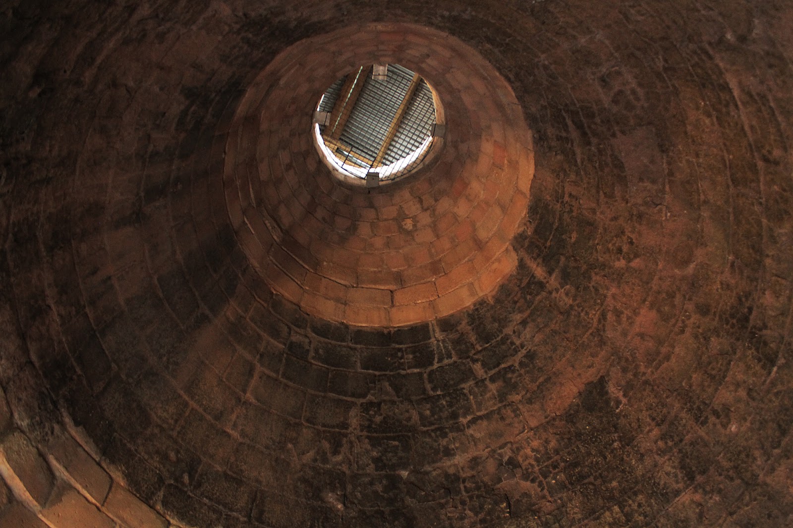
By the mid 1980s much of the site was un-used and quite a state when a selection of people were brought in to make the building safe. Many of these people took great interest in the site and decided, in 1998, to set up a trust to renovate the building, this was the start of the Newland Furnace Trust. Since then they have rebuilt the top of the furnace chamber, excavated the interior of the blowing chamber, re-boarded the floor of the large top room and generally looked after and renovated the site. In the image here you can see the inside of the furnace chamber and the clear line where the new bricks have been added ontop of the old ones. The old being blackened from the many years of charcoal fires raging around them. The work the group have done has been amazing and shows a real love for the furnace and will stand it in good stead to last well into the future.

The site is accessible from the outside and there are a few information boards to help you better under stand the building. On certain occasions the furnace does open on days like the Heritage Open Days for everyone to see inside, speak to members of the trust and learn more about this facinating building, so do keep an eye out!


Do come back on the 22nd when, instead of taking a look at one site, we will be looking at the whole of the Furness area in the Viking Age!